Revolutionizing Agriculture with Drone Powered Solutions
The impact of drone technology on India’s agriculture industry and its efficiency has been profound. Our company offers drone-powered solutions that significantly enhance productivity in various areas, including crop monitoring, planting, livestock management, pesticide spraying, crop stress identification, treatment planning, plant growth monitoring, precision farming, scouting, and much more.
Utilizing cutting-edge aerial surveying drones equipped with advanced sensors like RGB and multispectral sensors, we gather precise data. Specifically, the DJI Inspire 2 drones capture high-resolution crop data, allowing us to promptly identify any issues and take immediate action to prevent damage. The geo-tagged aerial images obtained from these drones provide valuable insights that reduce costs and greatly increase yield.
By leveraging advanced drone technology and machine learning for precision agriculture, we achieve remarkable improvements in crop yields and profitability. This approach significantly reduces the standard inputs required from farmers in terms of land maintenance, water usage, fertilizers, herbicides, and insecticides.
Our comprehensive approach combines UAV aerial imagery with state-of-the-art machine learning systems to deliver precise crop yield forecasts, accurate crop counts, crop emergence analysis, irrigation monitoring, crop health assessments, crop damage evaluations, and field soil analysis, among other benefits. With the help of high-quality drone data and photogrammetry techniques, we safeguard crops and ensure maximum productivity, empowering farmers with unparalleled advantages.
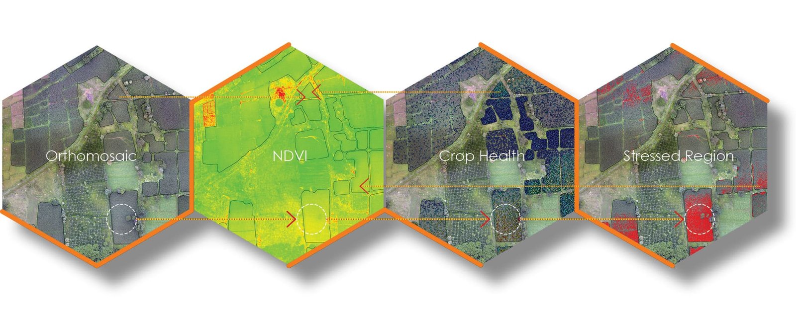
Crop Health Assesment
Crop Health Map
To understand the crop health data, an overlay map is generated to give an easy idea of analysis of the site. The points generated here on the maps carry the crop health information and pinpoint location information with an accuracy of 3 cm (approx.).
Stressed Crop Region
To identify the area of the stressed crop region the random points with the NDVI index values are used. The points indicating the stressed region are extracted and given a buffer of 0.3m (1 ft). From the Orthomosaic, the plant covering radius if 0.3m is observed. These generated buffers are merged to avoid overlaps and miscalculations and generate a crisp area of stressed crop.
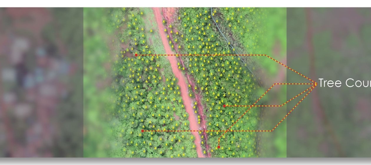
Forest mapping is challenging for various reasons, one being dense tree cover & poor ground visibility. Even using a multispectral sensor imaging the ground is difficult. & mapping trees is a very tedious job.
While working on forest mapping analysis can be performed in two major analytics, quantitative & qualitative. As the name suggests quantitative analysis is for the tree count, basically deriving the quantities in the forest. Whereas qualitative analysis us the derivation of the health of the forest using image processing algorithms.